The Way It Was
Tuesday, April 15th, 2014 | Author: admin
At my recent 50th class reunion, Bobby Burke brought some photos and some hand drawn maps that were his father’s. They were maps of some of Mr. Burke’s fishing spots in Lake Ferguson and photos of the same. The photos were taken in late 1960 and some of the maps were dated 1950. Bobby said that although they were keepsakes to him, he was giving them to me because he does not fish and they might be helpful to me. Very thoughtful. The river was cut off and Lake Ferguson made in 1932 only 18 years before the earliest of Mr. Burke’s maps.
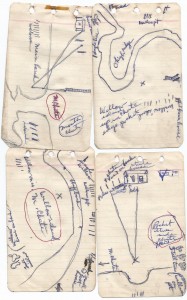
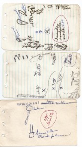
When I started fishing on Lake Ferguson there were only a handful of people who regularly fished for bass. Mr. Burke and Horace Polk were two who fished together and caught big strings of fish. They did it with direct drive reels (the ones that the handles spun when you would cast), braided nylon line, none of the good baits like we have today with the super sharp hooks, and no electronics with depth and GPS maps. They did not have trolling motors so they anchored and fished spots. Since they did not have all this good electronics, they took photos and drew maps. Here are four of Mr. Burke’s maps. You may have to turn your head sideways to read some of the writing and if you click on the picture it will zoom.
These are of “M” chute. I do not know what “M” stands for but I know what the chute is. Â The next three are of a hole across from the gravel company, another of the chute, and one of the rockpile.
Note that “X” usually marks the spot. Â The next ones are of a spot across from an orange barge, a spot at the sandbars and a spot across for the old Greenville Yacht Club where the “X” is where you anchor.
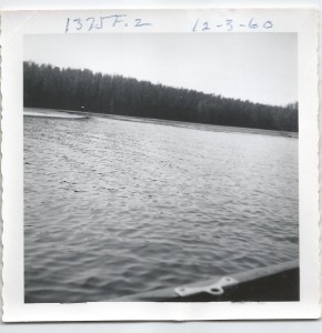
Then there are the photos. The first two are of the rockpile and were taken 12/3/60, over 53 years ago.
The next two are of places on the steep bank. I think I know where both are located.
The next ones are of the sandbars. You have to know many of the sharp dropoffs have eroded in the 53 years since these were taken.
The next one is of the mouth of the cute. The way it meanders I would bet the exact mouth has changed locations several times since this photo was taken.
This gives you an idea of how the fishermen of the 50’s and 60’s had to really work at their craft and use ingenuity to bring in all those big strings of fish. I thank Bobby for sharing his daddy’s maps and photos.
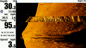
This is a screen capture from my depthfinder of a sunken barge in Lake Ferguson. It shows just how good we have it now. The next time you turn on your depthfinder / GPS just give it a little love pat.


